
Cities & local authorities
Nature intelligence for cities and territories
Measure, restore, and prove biodiversity outcomes — for your territory and the people who live in it.
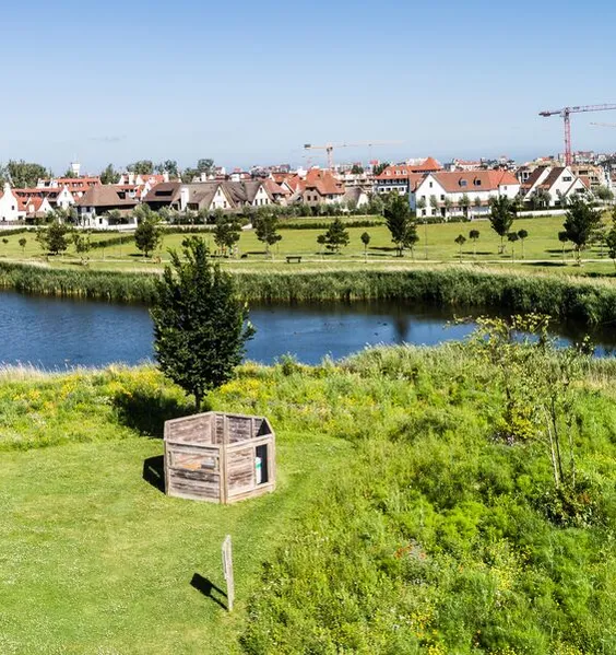
Cities and local authorities are at the forefront of the biodiversity challenge. Urban expansion, pollution, and climate change degrade green spaces and ecosystem services — the very things that make a city liveable, attractive, and resilient. At the same time, the EU Nature Restoration Law, the Biodiversity Strategy 2030, and CSRD obligations from municipal partners raise the bar on what cities must measure and report.
Residents expect more than promises: they want greener, healthier living environments and visible proof that their city is moving in the right direction.
BeeOdiversity provides nature intelligence — quantitative, repeatable monitoring combined with practical action plans — so cities can baseline their territory, design effective Nature-Based Solutions, demonstrate measurable progress, and engage citizens around results they can see and experience.
Where biodiversity matters for cities
Biodiversity shapes the quality of life in urban territories — from air quality and green spaces to community health and civic pride. Here is where it intersects with the challenges city leaders face every day.
Make biodiversity visible and measurable across your territory
Most cities lack a clear, quantitative picture of their biodiversity: what species are present, how green spaces are performing, where pollution is concentrated, and how things are changing over time. Without baseline data, it is impossible to set meaningful targets, prioritise investments, or demonstrate progress to residents and regulators. Quantitative monitoring that covers the full territory — vegetation, pollinators, pollutants, soils — gives you the evidence base to make informed decisions and communicate them with confidence. When citizens see concrete data and real improvements in the spaces they use every day, environmental policy becomes tangible and shared.
Reduce pollution & create healthier living environments
Pesticides in parks and public gardens, heavy metals near roads and industrial zones, PFAS in soils and water — urban pollution has direct consequences on public health, ecosystem functioning, and the attractiveness of a city. Identifying what pollutants are present, where they come from, and how they evolve over time is the first step to reducing them. Targeted reduction programmes — changing green space management practices, engaging local farmers, restricting harmful substances — deliver improvements that residents experience directly: cleaner air, safer parks, healthier neighbourhoods. Cities that can show measurable pollution reduction build trust with the people they serve.
Design effective Nature-Based Solutions with evidence
Tree planting campaigns, pollinator meadows, green corridors, urban wetlands — Nature-Based Solutions are a priority for many cities. But without pre- and post-intervention monitoring, it is difficult to know whether these investments are delivering real ecological outcomes or simply ticking a box. Evidence-based NBS design means selecting the right interventions for each site, tracking their impact with quantitative indicators, and adapting over time. Cities that invest in measurable NBS can prove that public money is well spent — and scale what works across the territory.
Meet regulatory obligations & lead by example
The EU Nature Restoration Law requires measurable improvement in urban ecosystem quality. The Biodiversity Strategy 2030 sets targets for green spaces, pollinator populations, and pesticide reduction. CSRD-reporting partners and EU-funded consortia (Horizon Europe, Interreg) demand robust, comparable indicators. Cities that adopt science-based monitoring are not just complying — they are positioning themselves as leaders in the transition, attracting EU funding and recognition, and setting a standard that inspires civic engagement. A municipality that can show its territory is measurably healthier and more biodiverse earns something no regulation requires: the pride and active participation of its residents.
From data to action: how BeeOdiversity delivers
BeeOdiversity is a unique partner combining nature-based monitoring, strategic consulting, and action management at territorial scale. We help cities and local authorities move from qualitative ambitions to quantitative, repeatable evidence — with science-backed data that regulators, consortium partners, and residents trust.
Strategy & prioritisation
Screen — Prioritise — Plan
Screen your territory using satellite imagery and AI-driven geospatial analysis to identify priority zones — where biodiversity gaps, pollution pressures, and ecological connectivity issues are concentrated. Our consultants translate this mapping into a practical biodiversity strategy: site prioritisation, NBS design recommendations, and alignment with EU frameworks.
BeeOimpact
Map biodiversity potential and pollution exposure across your entire municipality or metropolitan area — parks, green corridors, peri-urban farmland, waterways. Identify ecological connectivity gaps and NBS opportunity zones at low cost, before committing to on-the-ground investment. Compare neighbourhoods and sites, rank them by biodiversity need and restoration potential, and build a prioritised action plan grounded in spatial evidence rather than assumptions.
BeeOconsult
From territorial biodiversity diagnostics to multi-year green strategies. Site selection for NBS, stakeholder engagement frameworks (farmers, schools, citizen groups), and alignment with the Nature Restoration Law, Biodiversity Strategy 2030, and CSRD reporting obligations. Training for municipal green space teams on biodiversity-positive management practices — reducing herbicides, adapting mowing schedules, selecting native plantings that sustain pollinators and soil health year-round.
Monitoring & evidence
Measure — Detect — Demonstrate
On priority sites across your territory, we deploy nature-based monitoring solutions that deliver quarterly, multi-parameter data — vegetation, pollinators, pollutants, and soils in a single comparable programme. Non-intrusive, operationally simple, and designed to produce the quantitative, repeatable evidence that EU frameworks and citizens expect.
BeeOmonitoring
A patented, nature-based approach using bees as living sensors across 700 ha (1,800 acres) per station. Quarterly data on plant diversity, pollinator health, and 500+ contaminants — pesticides, heavy metals, PFAS, PAHs — with source attribution. An early warning system that detects pollution trends and vegetation changes across your territory with a level of coverage and sensitivity that conventional inventories cannot match. Pre/post-intervention monitoring with statistically robust indicators: quantitative evidence of NBS impact that is comparable across sites, repeatable over time, and directly usable in EU programme reporting and citizen communication.
BeeOtel
A scalable, low-cost device to assess wild pollinator presence and biodiversity at neighbourhood level — 40 ha (100 acres) per unit. Deploy across parks, green corridors, school gardens, and peri-urban zones to build a fine-grained map of pollinator health across your city. An engaging, visible tool that connects citizens with nature in their neighbourhood — residents and school groups see the devices, learn about pollinators, and follow the results. Biodiversity becomes part of the daily conversation, not an abstract policy goal.
BeeOsoil
Urban soils are compacted, sealed, or contaminated — yet they are the foundation of every green space and NBS investment. eDNA-based soil analysis reveals microbial diversity, communities associated with key functions (nitrogen fixation, water filtration, disease suppression), and soil health indicators that predict whether a planting or restoration project will take root. Compare soil functionality across parks, roadside verges, and restored sites. Track how NBS interventions improve soil biodiversity over time — the invisible infrastructure beneath every visible green space.
BeeOsurvey
On-site ecological inventories by our Suitably Qualified Ecologists — establishing baselines on habitat quality, species richness, and ecological connectivity across your parks, waterways, and peri-urban zones. Identification of indicator and protected species, invasive species mapping, and assessment of green corridor functionality — the field-level data that grounds urban biodiversity strategies in ecological reality and feeds regulatory reporting.
Actions & reporting
Act — Track — Communicate
Turn monitoring data into measurable improvements across your territory — through expert ecological guidance, citizen engagement, and a centralised action management platform.
Ecological expertise
Our ecologists design site-specific interventions: adapted planting strategies taking into account the local ecosystem and municipal budget, pollinator meadows, green corridor restoration, herbicide reduction pathways, and urban wetland design. Awareness programmes for schools and citizens — educational paths, seed bag distribution, community planting days — that turn residents into active participants in the city's biodiversity story. Training for green space managers on sustainable landscaping and biodiversity-positive maintenance. Communication plans and press engagement to amplify results.
BeeOinitiative
Define site-level objectives, select from 80+ scored initiatives (biodiversity impact 1–5, cost), and track implementation across all your parks, green spaces, and peri-urban zones with standardised KPIs. Each site has its own dashboard — initiatives, progress, timelines, budgets. Aggregated metrics across the whole territory feed directly into Nature Restoration Law reporting, EU programme deliverables, and citizen-facing communication. One platform to steer your biodiversity strategy from neighbourhood to municipality.
For day-to-day green space management, BeeOgarden gives municipal teams and community gardeners a hands-on companion: identify existing plant species across parks and public gardens, select native plantings adapted to each site's conditions, and build a living vegetation inventory for the territory — making green space decisions biodiversity-positive by default and engaging citizens as active contributors.
Regulatory alignment
Our solutions support compliance with the frameworks that matter to cities and local authorities.
EU Nature Restoration Law
Measurable improvement in urban ecosystem quality, pollinator populations, and green space indicators
Biodiversity Strategy 2030
Targets for urban greening, pesticide reduction, and pollinator-friendly city management
CSRD / ESRS E4
Reporting support for municipal partners and utilities with biodiversity disclosure obligations
EU Taxonomy
Do No Significant Harm biodiversity criteria for urban infrastructure and development projects
EU Mission: Climate-Neutral & Smart Cities
Biodiversity indicators and NBS impact data for mission-city reporting
Horizon Europe & Interreg
Quantitative, comparable monitoring deliverables for EU-funded consortia