
Linear infrastructure
Integrating biodiversity across your network
Prioritise, measure, and prove the effectiveness of your biodiversity actions — at network scale, at controlled cost.
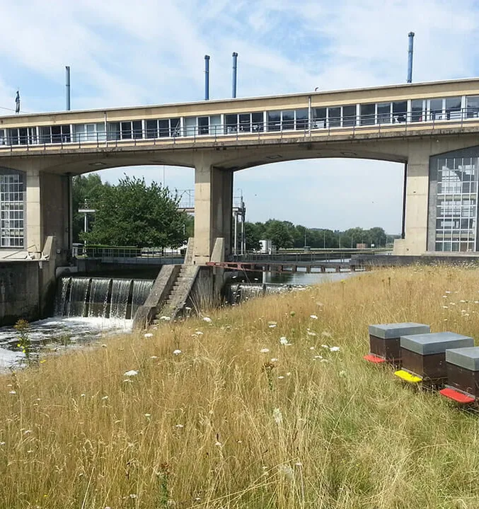
Power grids, railway lines, waterway concessions, gas pipelines — linear infrastructure operators manage tens of thousands of kilometres under growing regulatory pressure. The energy transition and decarbonisation of mobility are multiplying new projects and permitting procedures, while existing rights-of-way face the phase-out of chemical herbicides, the spread of invasive species, and increasing biodiversity obligations.
Yet the question is never "measure everywhere" but "where to act, and how to prove it."
BeeOdiversity combines remote sensing, nature-based field monitoring, and strategic consulting to help you screen your entire estate, focus investment where it matters, and build the defensible evidence that authorities, investors, and stakeholders expect.
Where biodiversity matters for linear infrastructure
Infrastructure networks cross some of the most ecologically diverse and sensitive landscapes. Whether you operate power lines, railways, waterways, or pipelines, biodiversity intersects with your operations at every stage — from project planning to ongoing maintenance and regulatory compliance.
Prioritise across vast networks at controlled cost
With estates spanning tens of thousands of hectares, field-auditing every kilometre is neither realistic nor useful. Yet regulators and stakeholders expect you to know where the sensitive areas are and to demonstrate that your decisions are based on ecological evidence, not guesswork. The challenge is to screen your entire network quickly, identify the priority zones — where habitats, protected species, and ecological connectivity intersect with your operations — and concentrate monitoring and investment where they will have the greatest impact. Remote screening at portfolio level, followed by targeted ground-truth verification, is the only approach that scales.
Secure permits & prove no net loss over time
Every new line, substation, or concession renewal triggers environmental permitting — and the avoid-reduce-compensate (ERC) sequence that comes with it. Authorities increasingly require operators to demonstrate no net loss of biodiversity, not just at the moment of intervention, but over time. That means establishing a robust baseline before works (T0), then follow-up monitoring (T1, T2) to document whether compensation measures are actually delivering the ecological outcomes they promised. Without this layer of temporal proof, permit applications remain vulnerable and compensation claims unsubstantiated.
Adapt maintenance practices to biodiversity constraints
Right-of-way maintenance — felling, pruning, clearing, mowing — is a major recurring cost, and doing it wrong can trigger biodiversity damage, regulatory sanctions, and reputational risk. The phase-out of chemical herbicides adds complexity, while invasive species spread faster than management programmes can contain them. Operators need to know which zones require adapted methods (deferred to winter, manual clearing, late mowing), which can follow the standard schedule, and how to document these decisions in a way that is defensible to environmental authorities. Turning maintenance from a cost-driven exercise into an evidence-based biodiversity management programme protects your operations and your licence to operate.
Meet CSRD, TNFD & stakeholder expectations
CSRD (ESRS E4) requires disclosure of biodiversity impacts, dependencies, and transition plans — including across linear assets and rights-of-way. TNFD's LEAP approach calls for location-specific nature-related risk assessment. Environmental authorities, local communities, municipalities, and NGOs expect transparent evidence that your network contributes positively to the landscapes it crosses. Infrastructure operators that can demonstrate measurable biodiversity outcomes — not just policy commitments — gain faster permitting, smoother stakeholder dialogue, and stronger ESG positioning with investors and concession grantors.
From screening to proof: how BeeOdiversity delivers
BeeOdiversity is a unique partner combining remote sensing at portfolio scale, nature-based field monitoring on priority sites, and strategic consulting — from network-wide screening down to individual rights-of-way. We help infrastructure operators move from broad risk mapping to ground-truth evidence, with science-backed data that authorities, concession grantors, and stakeholders trust.
Strategy & prioritisation
Screen — Prioritise — Plan
Screen your entire network or concession using satellite imagery and AI-driven geospatial analysis to identify where biodiversity sensitivity is highest. Our consultants then translate this mapping into operational recommendations: which zones require adapted maintenance, where to deploy ground-truth monitoring, and how to build a network-wide nature strategy aligned with your permitting, reporting, and concession obligations.
BeeOimpact
Map biodiversity sensitivity across your entire estate — hundreds of thousands of hectares — on a 1–5 scale using habitat data, protected areas, species occurrences, and ecological connectivity analysis. Cross-reference with your maintenance schedule and operational constraints to identify priority zones quickly and at low cost.
The result: from tens of thousands of hectares screened, a short list of priority sites where ground-truth monitoring and adapted practices will have the greatest impact — without attempting the impossible audit of every kilometre.
BeeOconsult
From biodiversity risk assessments to network-wide nature strategies. Materiality analysis, site prioritisation across your concession or grid, ERC sequencing support, and alignment with CSRD, TNFD, and the LEAP approach.
Our consultants also design decision-support frameworks that translate sensitivity maps into clear operational rules — which zones to defer to winter, which require an adapted method, and which can follow the standard schedule — so biodiversity intelligence reaches the teams on the ground.
Monitoring & evidence
Measure — Verify — Document
On the priority sites identified in Step 1, we deploy nature-based monitoring solutions that go beyond inventory: they generate the field-level evidence you need to prove no net loss, document compensation outcomes over time, and build the defensible record that authorities and concession grantors require.
BeeOmonitoring
Obtain plant diversity data and ecosystem pollinator health data at landscape level — 700 ha (1,800 acres) per station — to establish robust baselines (T0), measure the effectiveness of compensation or restoration measures over time (T1, T2), and detect changes in floral diversity linked to maintenance practices.
Identify pollutants circulating across the landscape (pesticides, heavy metals), assess their origin and impact on ecosystem services, and build the quantitative evidence base that environmental authorities and permitting bodies require — defensible, repeatable, and comparable over time.
BeeOtel
A scalable, low-cost device deployable across multiple sites along your network to assess pollinator presence and biodiversity at parcel level — 100 ha. Ideal for covering more points across a linear corridor than a single landscape-level station can reach.
Rank and compare zones within your right-of-way, identify where pollinators are thriving and where ecological pressure is highest — giving your maintenance teams the granularity they need to adapt practices site by site.
BeeOsoil
Rights-of-way and concession areas are affected by soil compaction, contamination, and disturbance from construction and maintenance activities. eDNA-based soil analysis reveals biological functionality beneath the surface: microbial diversity, water retention, nutrient cycling, and natural resistance to invasive species.
Track how soil health evolves before and after interventions, compare zones under different management regimes, and generate indicators that link soil biodiversity to the ecological outcomes permitting authorities care about.
BeeOsurvey
On-site ecological inventories by our Suitably Qualified Ecologists — establishing baselines on habitat quality, species richness, and ecological connectivity along your corridors and at key intervention sites.
Identification of protected and indicator species, invasive species mapping, assessment of riparian zones and buffer strips — the regulatory-grade field data that grounds your ERC obligations and feeds permitting dossiers.
Actions & reporting
Act — Track — Communicate
Turn monitoring data and sensitivity mapping into measurable outcomes across your network — through expert ecological guidance and a centralised action management platform.
Ecological expertise
Our ecologists design corridor-specific interventions: pollinator habitat restoration along rights-of-way, buffer zone management, invasive species containment strategies, native planting plans, and adapted mowing or clearing schedules calibrated to reproductive periods.
Stakeholder engagement with local municipalities, environmental authorities, and conservation partners — because infrastructure projects succeed faster when biodiversity management is co-constructed with the territories they cross.
BeeOinitiative
Define site-level objectives, select from 80+ scored initiatives (biodiversity impact 1–5, cost), and track implementation across your entire network with standardised KPIs — from individual rights-of-way to network-wide dashboards.
Each zone has its own action plan — initiatives, progress, timelines, budgets. Aggregated metrics feed directly into CSRD/ESRS E4 and TNFD reporting, concession renewals, and permit compliance documentation. A single steering tool for the whole estate.
Regulatory alignment
Our solutions support compliance with the frameworks that matter to infrastructure operators.
ERC sequence
Baseline and follow-up monitoring to substantiate compensation commitments
CSRD / ESRS E4
Mandatory biodiversity impact, dependency, and transition plan disclosure
TNFD
LEAP: location-specific nature-related risk assessment across linear assets
EU Taxonomy
Do No Significant Harm biodiversity criteria for infrastructure investments
Habitats & Birds Directives
Protected species and habitat obligations in Natura 2000 and adjacent zones
Environmental permits
Defensible ecological evidence for permitting, concession renewals, and public inquiries